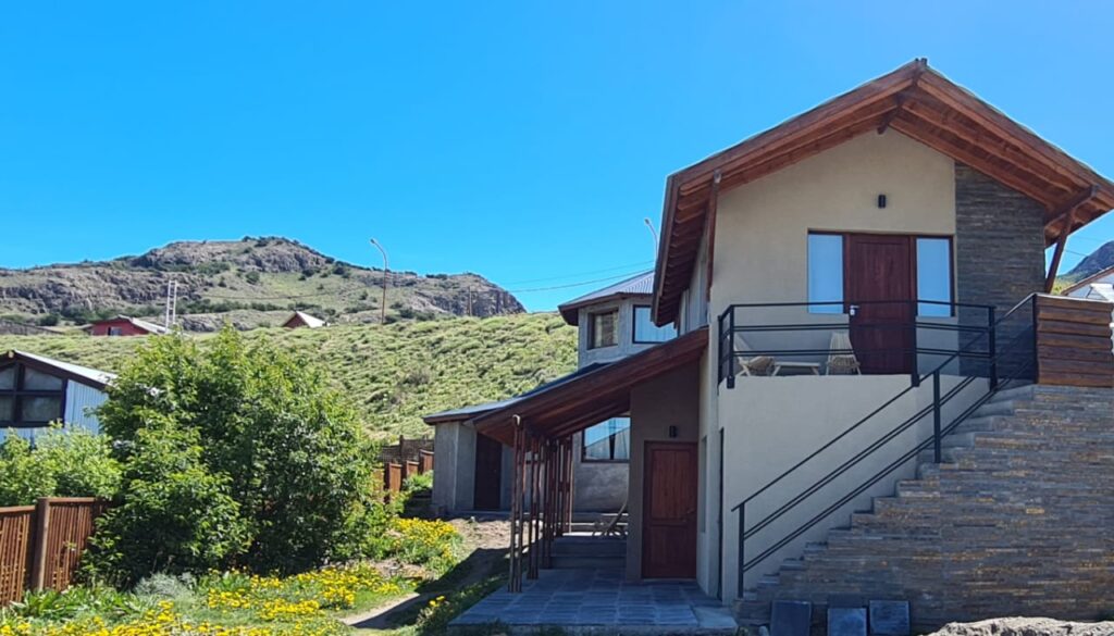

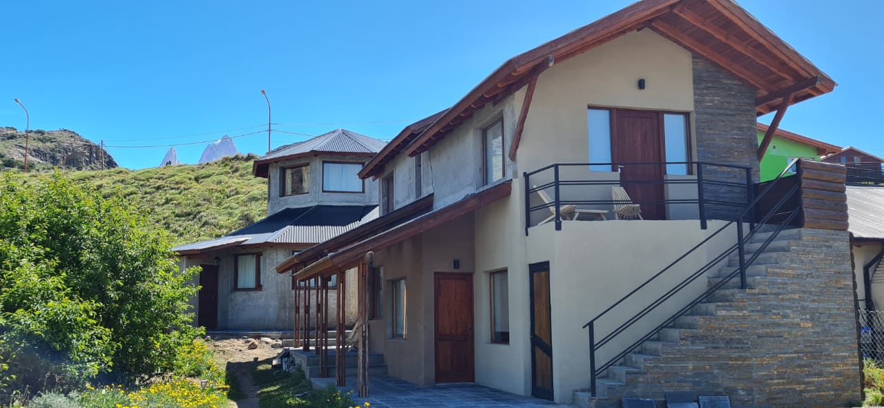
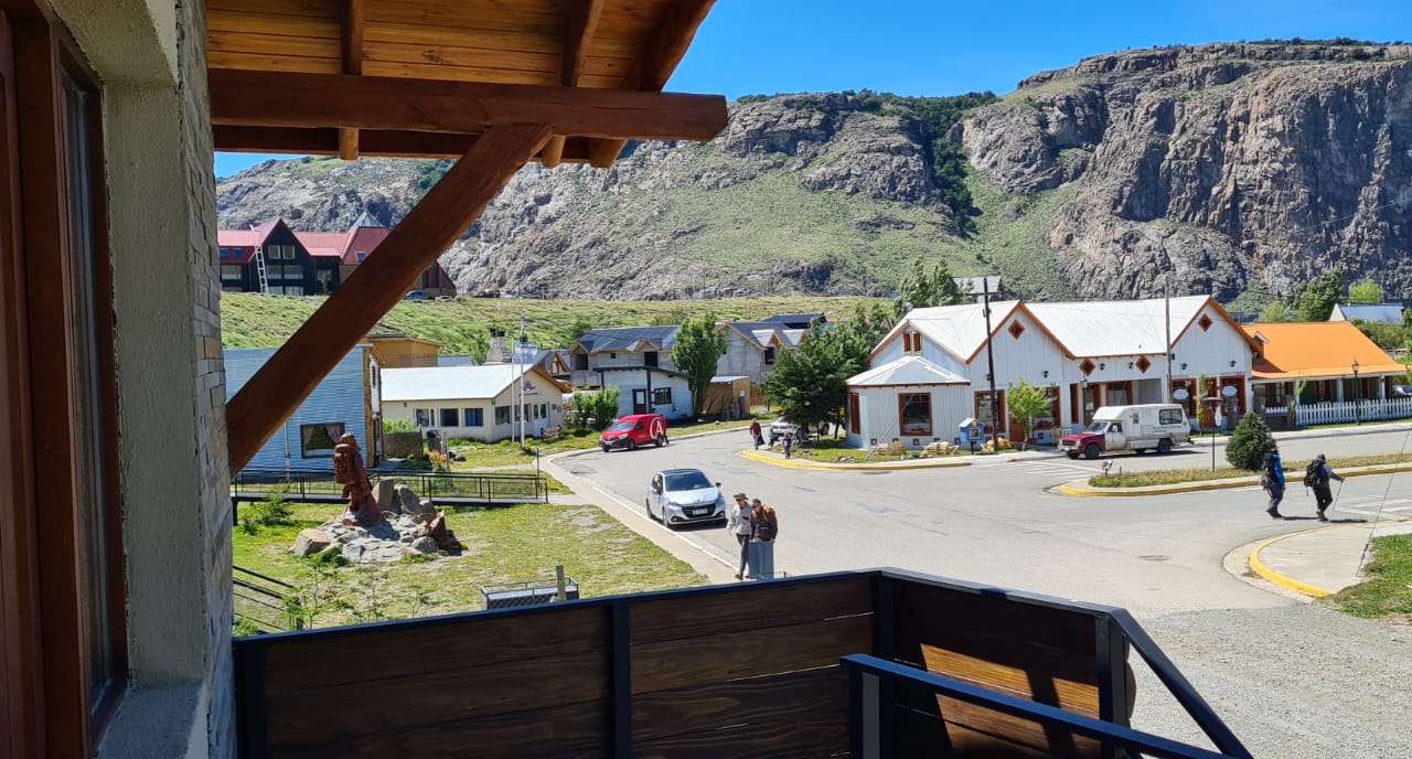


Kuntur Chalten is located 20 meters from Antonio Rojo Avenue on Comandante Arrua Street 387. We are at the foot of the stairs leading to the upper floor of the village and 400 meters from Avda. San Martin. A strategic place that allows you to easily access all tourist sites, bars, restaurants, and supermarkets.
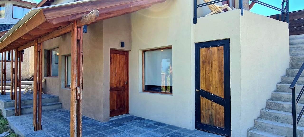
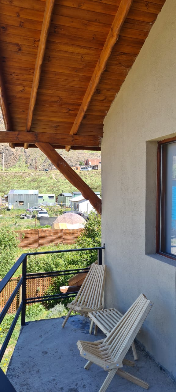
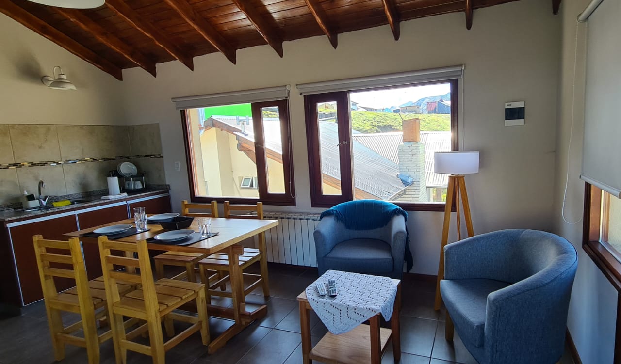
The complex is composed of an apartment on the upper floor with an exclusive balcony and two apartments on the ground floor on a gallery with views of the green space of the property.
Points of reference.
Trails:
500 meters The beginning of the path that leads to the Glacier and Torre Lagoon, DAgostini Camp, Maestri Lookout (detour to Madre e Hija Lagoon) 950 meters The start of the path that leads to Laguna de los Tres, Rio de las Vueltas Lookout, Capri Lagoon, Fitz Roy Lookout, Poicenot Camp, Detour to Madre e Hija Lagoon 1.1 kilometers The Los Glaciares National Park Visitor Center, the start of the path to Toro Lagoon, Lomo del Pliegue Tumbado, Condor Lookout and Agilas Lookout 800 meters The paredón lookout is 800 meters away.”
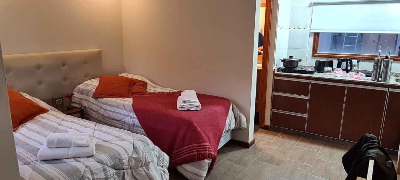
Apartment to accommodate
up to 4 people
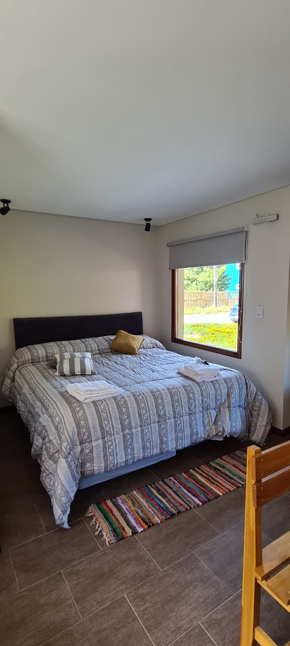
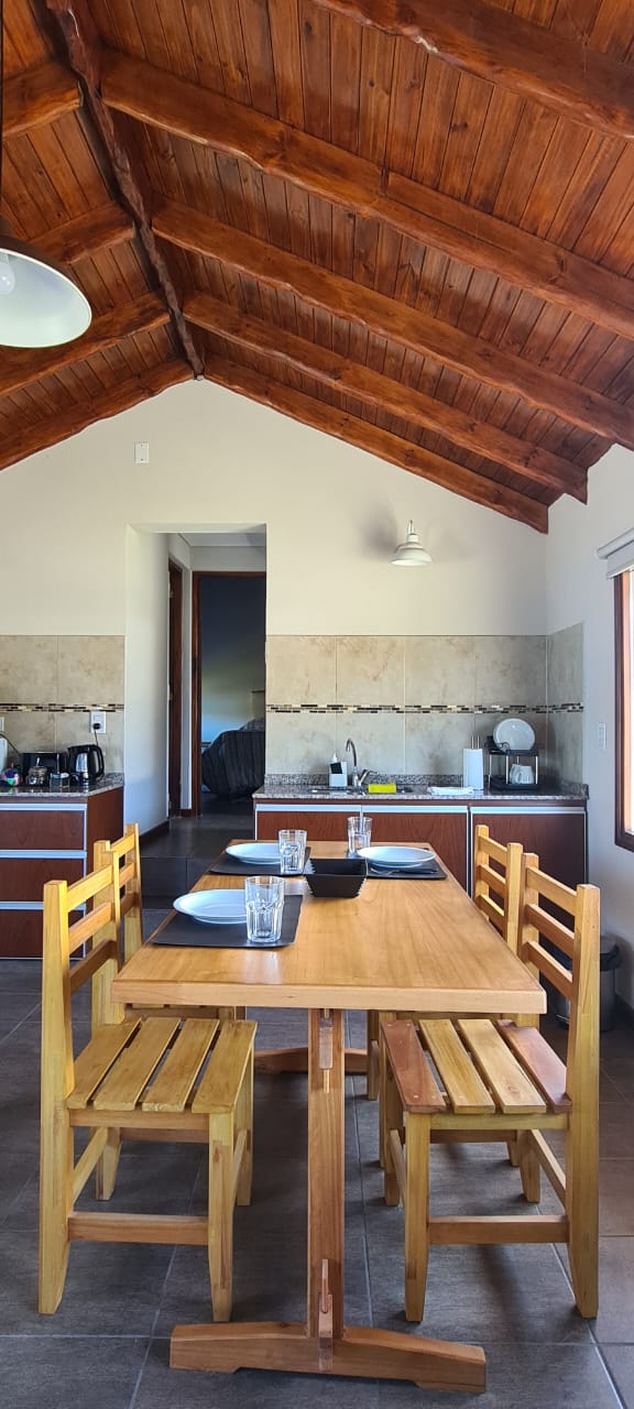
Spacious and bright 1 bedroom apartment located on the upper floor
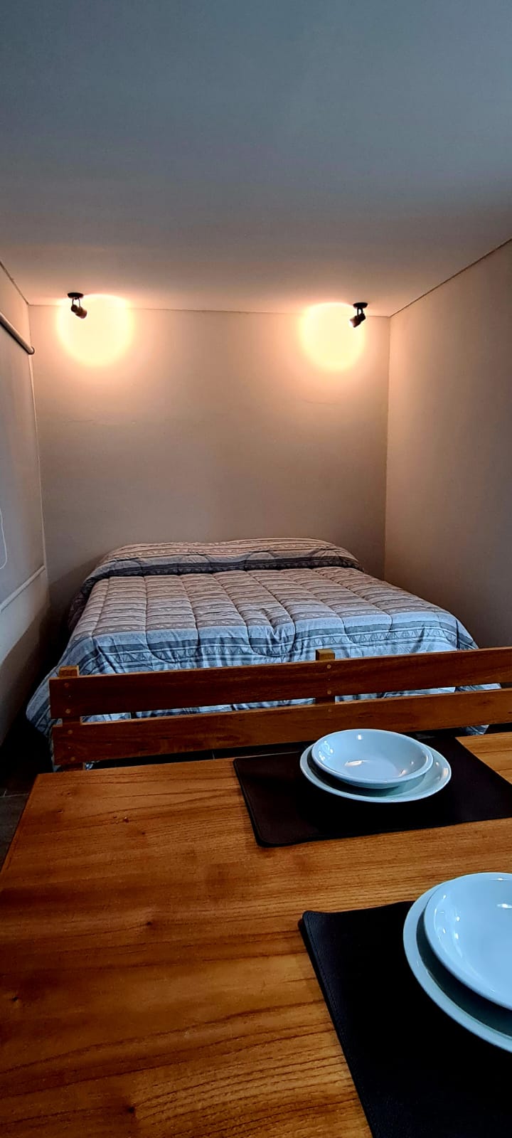
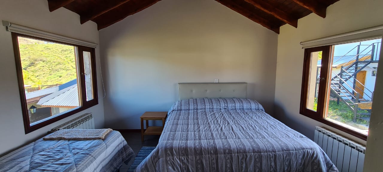
Spacious 45 sqm apartment, with internet connection via Wi-Fi. It has a bedroom with the option of a king size bed (1.90 by 2.00) and a twin or 3 twin beds (0.90 by 2.00). Heating by radiators (2 units). 2 large windows with blackout roller curtains that allow the environment to be completely darkened. High density foam rubber mattresses, intelligent pillows, and excellent quality bedding will allow you to achieve a very good sleep and thus regain strength to start the day renewed to live a new adventure.
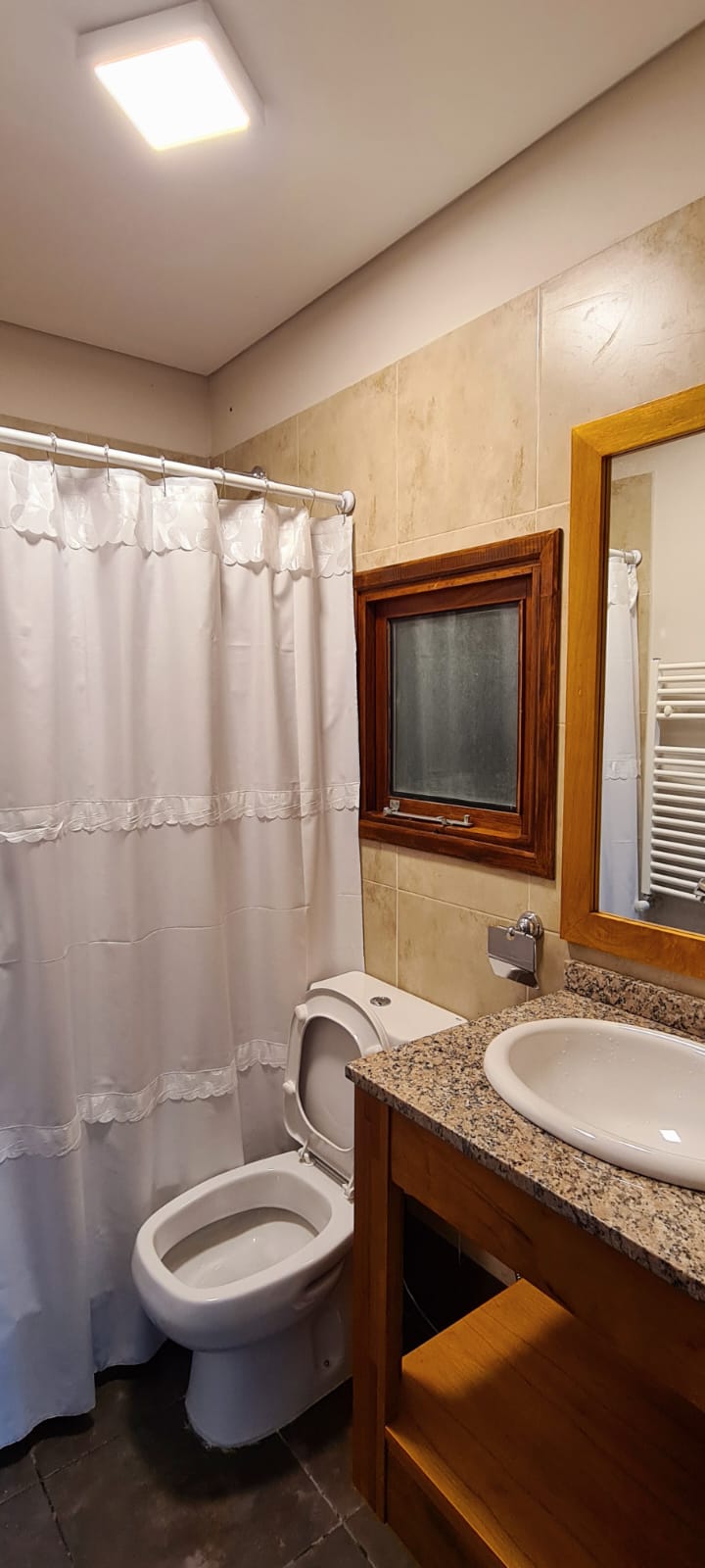
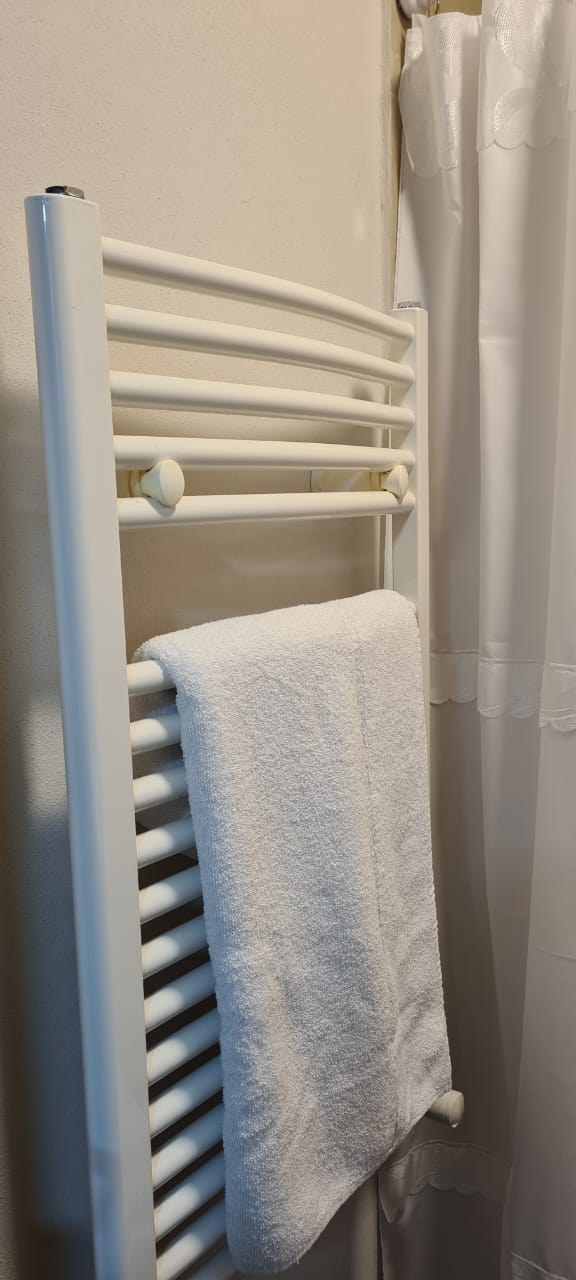
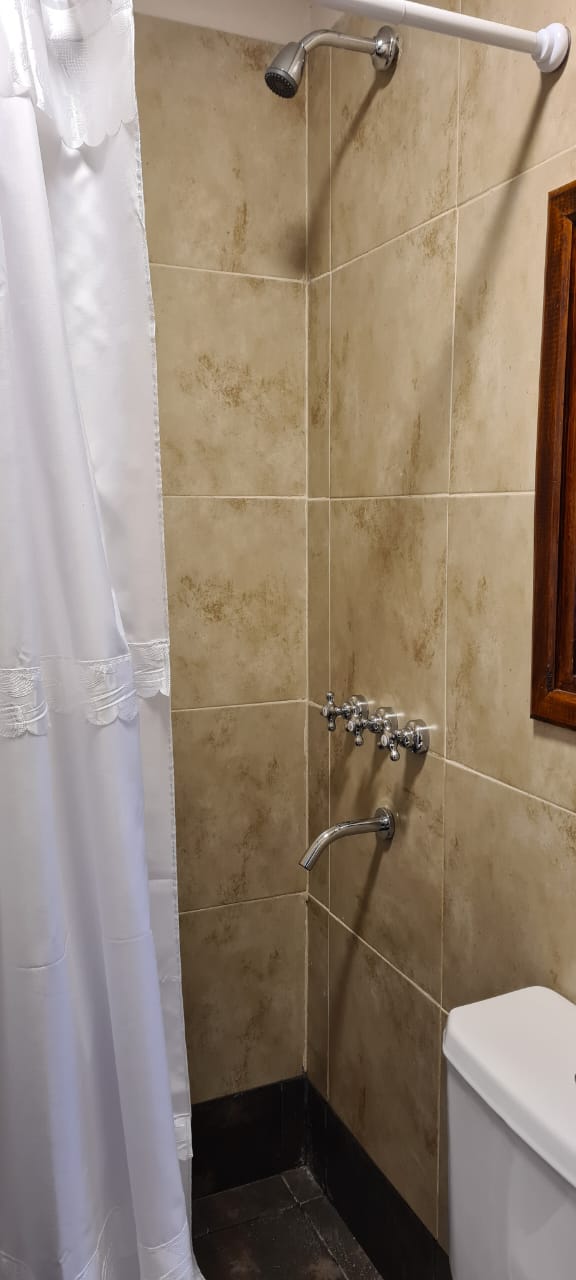
Padded, sheets, Fundsa and blankets renewed for this season. Full bathroom consisting of a shower room (no bathtub) + toilet room with sink, large mirror, storage cabinet, toilet, hand bidet, liquid soap dispenser, hair dryer. Both bathroom rooms with towel radiators. New towels and bath sheets.
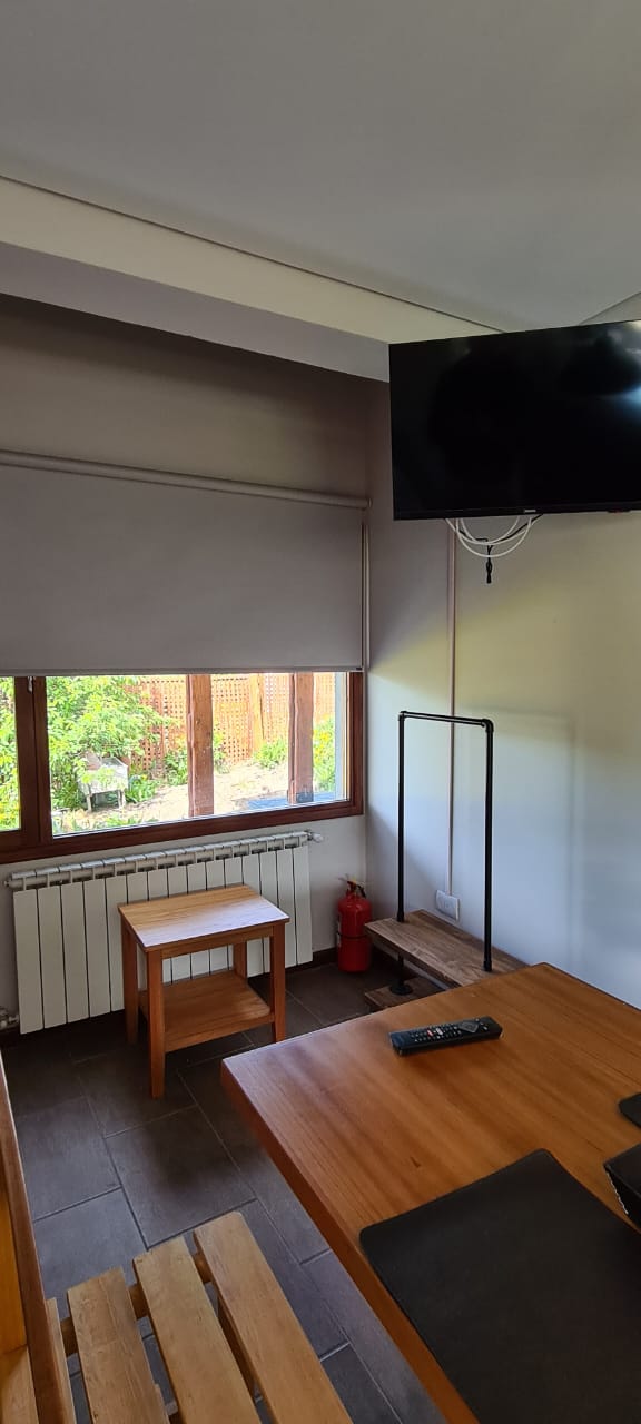
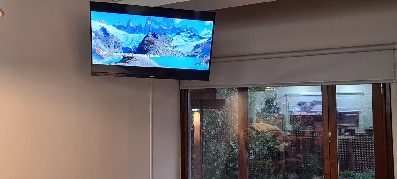
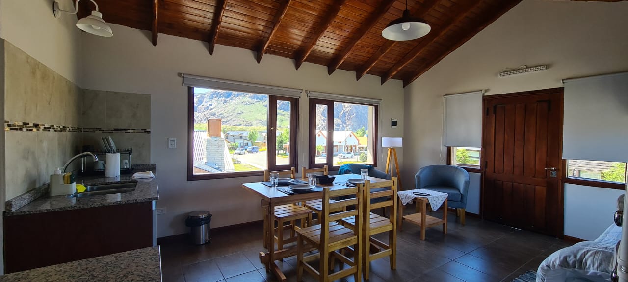
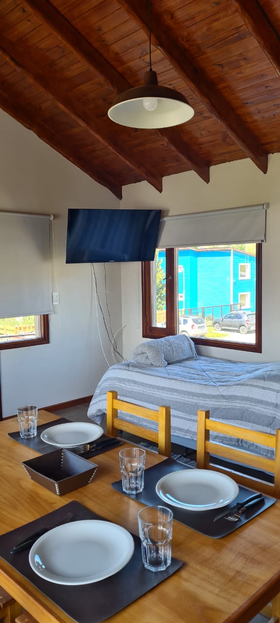
Kitchen and dining room: Fully equipped kitchen with filter coffee maker, electric kettle, toaster, microwave, electric stove with 2 burners, refrigerator with freezer, pot, pan, jug, boards, cutlery and complete crockery. Table and chairs for 4 people. In addition, it has a 40-inch smart TV (Direct Tv). Space with 2 armchairs, side table and floor lamp. Ideal for creating a reading or music atmosphere to relax, watch TV.
In this environment there is also an option of a twin bed. Which can also be designed to be used as a sofa bed to rest and/or watch TV.
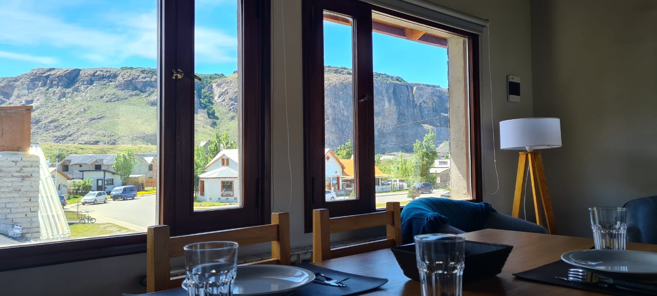
It has 3 large windows with blackout curtains. Large balcony with 2 chairs and wooden table protected from rain and wind. All appliances refrigerator and crockery are brand new this season 2022/23. Integrated apartment to accommodate up to 2 people”.
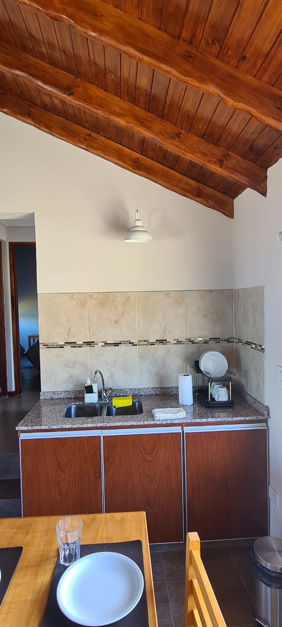
Studio apartments that can accommodate up to 2 people
Spacious and comfortable 28 sqm studio apartment fully equipped with radiator heating. It has a fully equipped kitchen with a fridge with a freezer. Electric stove with 2 burners, microwave, coffee maker, toaster, electric kettle. Bed, option of 2 Twin or 1 double (King size). Single armchair. Table with stools. Internet connection. Smart TV with Direct Tv service. WI Fi. Bathroom with shower, hairdryer, towel radiator. Hand bidet. Toiletries. Large mirror. Outdoor gallery with exclusive rest area with chairs and small table. All furniture, linens and appliances are brand new for this season 2023.
Comandante Arrua 387
+54 9 3416 08-6139
info@kunturchalten.com.ar
©kuntur chalten | 2022
Nuestro clima patagónico se destaca por dos razones ráfagas de vientos fuertes y un particular carácter impredecible y cambiante. Como solemos bromear: Patagonia? Las cuatro estaciones del año en un día, pero dos veces!
No hay un mes característico por su buen clima sino que se trata más bien de una suerte de lotería. Por lo tanto se hace imposible recomendar un mes para su visita.
Más allá de esto, el final de la primavera, el verano y el nacimiento del otoño suelen ser la época de mayor afluencia de visitantes a este Parque Nacional con la característica de días especialmente largos por nuestra cercanía al Polo Sur en oposición a la escasa cantidad de horas con luz solar en un típico día de invierno; (en verano puede haber luz desde las 5 am hasta las 22:30) lo que nos da mucho margen para caminata más largas y exigentes a un ritmo más relajado.
A tener en cuenta los días comienzan a alargarse a mediados de noviembre cuando hay luz de día hasta las 9/9:30 P.M.
El otoño (fines de marzo abril y principio de mayo) si bien con días más cortos suele ser la época mas especial y hermosa debido a la coloración de los bosques ya que los nothofagus, Lengas y Ñires, árboles característicos de la zona tiene hojas caducifolias es decir que pierden sus hojas en el invierno no sin antes tomar una gradual e intensa coloración que va de amarillo y rojo intenso y el pueblo se vuelve un poco más tranquilo y silencioso por la merma de la afluencia de visitantes.
El Chaltén es un pueblo pequeño y asombrosomante joven, situado a 218 km al noroeste de la localidad del Calafate.
Bus:
El recorrido desde el calafate es de aprox. 3 ½ horas. Consulte vigencia de horarios y tarifas con cada compañía.
DON ATILIO:
reservas@zonaaustralturismo.com
precio por tramo:
frecuencia coordinada con la llegada y partida de los vuelos Dde y hacia el aeropuerto de El Calafate
TAQSA:
Tel 02962 493130
taqsaech@taqsa.com.ar
precio por tramo: $2.900
frecuencia: El Calafate El Chalten 7.30 hs
El Chalten – El Calafate 17.30
LAS LENGAS:
laslengaselchalten@yahoo.com.ar
Tel 02962 493023
precio por tramo: $650
frecuencia: 7:30am y durante todo el dia dde aeropuerto coordinado con los vueltos
tambien directos dde El aeropuerto de El Calafate directo a su hospedaje en El Chalten
Caltur:
terminalchalten@hotmail.com
tel 02962 493 150
Precio por tramo $ 600
sale 8, 13 y 18.30 hs
Chalten Travel:
infochalten@chaltentravel.com
02962 493 192
Precio por tramo $ 600
sale 8, 13 y 18.30 hs
Los pasajes siempre se pueden sacar directamente en la Terminal de Buses de El Calafate y los de las compañias Caltur y Chalten Travel que son las mas grandes se pueden sacar por adelantado en
www.plataforma10.com
Auto:
218 kilómetros de Calafate por ruta provincial 11, ruta nacional 40 y ruta provincial 23 o 41 (Asfaltado)
468 kilometros desde Río Gallegos por ruta 5, ruta provincial 11, ruta nacional 40 y ruta provincial 23. (Asfaltado)
Avión:
El Chaltén no cuenta con aeropuerto propio. Los Aeropuertos más cercanos son el de El Calafate ( con más de 10 vuelos diarios de Aerolíneas Argentinas, JetSmart y Flybondi), el de Río Gallegos, el de Ushuaia.
El Chaltén se destaca por tener una amplia variedad de actividades al aire libre de las cuales las más practicadas en el trekking y la escalada ya sea alpina o deportiva!
Y aquí van algunas sugerencias, aquellos lugares que recomendamos no dejar de visitar en su paso por Chaltén.
A tener en cuenta: caminar solamente se trata de poner abrigo y algo de comer y una botella de agua en la mochila y salir a disfrutar de nuestro entorno gratis, sin reservas previas y sin horarios pre establecidos. También le ofrecemos algunas actividades organizadas las cuales si tienen un costo…
A todos aquellos que vayan a realizar actividades en el Parque Nacional les recomendamos visitar el centro de visitantes en la oficina de Parques Nacionales: Allí se le brindará información sobre los senderos, su duración y dificultad, información de flora, fauna e historia del alpinimo del lugar: No se lo pueden perder!
Recuerde al caminar: primero que nada: disfrute.
Si en algún momento siente alguna molestia (roce de la bota, dolor de las rodillas) de la vuelta dado que aún le queda el regreso. Si bien los tiempos publicados son orientativos manéjese en horas de caminata, y no olvide que el tiempo de ida será igual que el de regreso!
EXCURSIONES
TREKKING
Para salir caminando desde inlandsis:
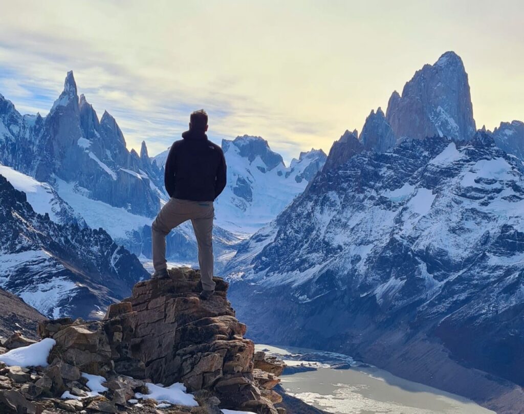
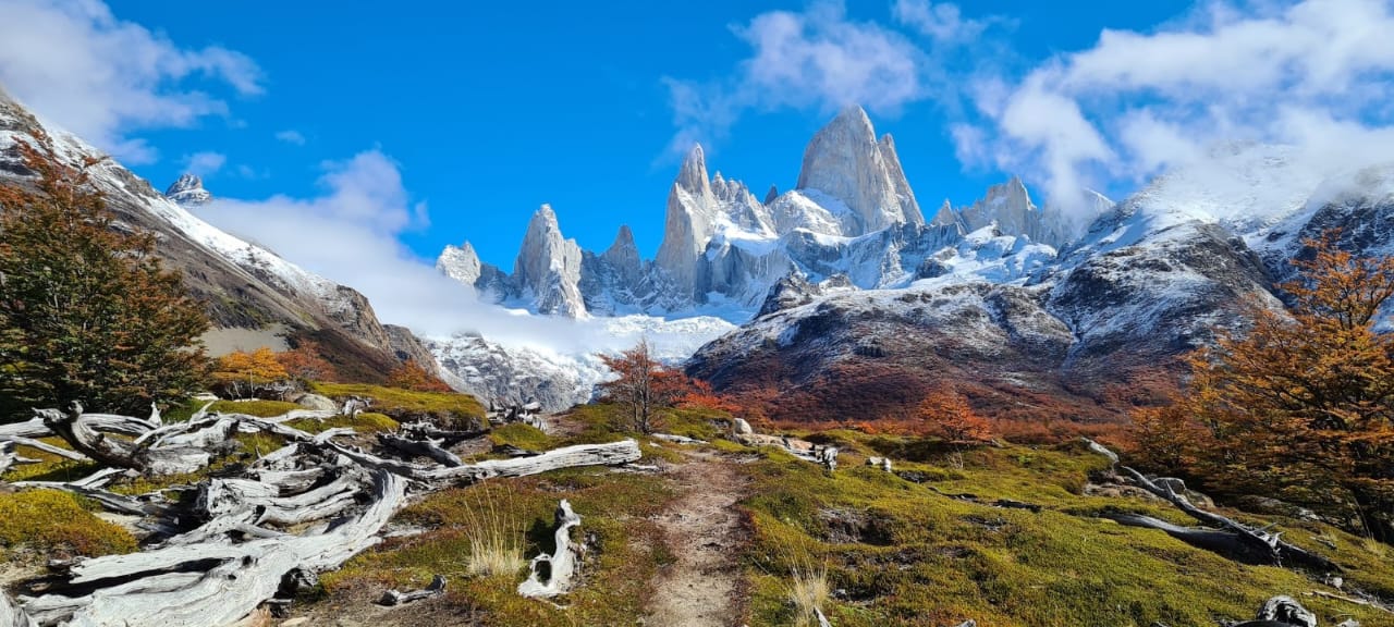
Fitz Roy
El Pilar/campamento Poincenot/mirador piedras blancas/laguna de los tres Laguna Capri/Chaltén
Este sendero nos ofrece el panorámico más cercano del cordón del Fitz Roy.
Puede empezarse desde El Chalten, simplemente caminando hasta la salida Norte del pueblo, tomando hay en sendero.
O bien desde la hostería El Pilar a 15 kilómetros El Chaltén puede hacerse en auto o con transfer – todos los días con pickup en la posada las 8:30
Nuestra recomendación es arrancar desde Pilar, dado que de esta manera simplemente caminamos de vuelta hasta El Chaltén, y recorrido en más corto y con mayor vista.
Saliendo del Pilar luego de 2 horas de caminata se llega al mirador del glaciar Piedras Blancas y su Laguna homónima.
Siguiendo por el sendero 40 minutos más, se llega al campamento Poincenot (campamento para senderistas)
El sendero que sigue está la laguna de los tres es empinado y exigido.
Se cruza el río Piedra Blanca para luego cruzar el campamento Río Blanco (campamento sólo para escaladores)
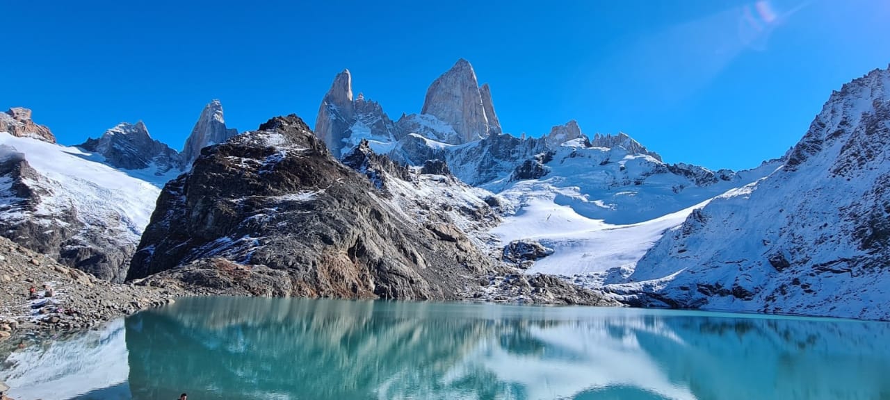
Aquí en sendero comienza a hacerse empinado y luego de 1.45 se llega a la laguna de los tres.
Desde aquí se obtiene una hermosa y la más cercana a vista del cordón del Fitz Roy.
Para regresar: desde el campamento Poincenot se toma el sendero que indica El Chaltén Y es que lo llevará por la laguna Capri hotel pueblo en 2:30 horas.
O simplemente se toma el camino a Pilar en caso de que haya dejado allí su auto.
Tiempo total de marcha 9 / 10 horas aproximado.
Cerro Torre
Laguna Torre – Campamento de Agostini – Mirador Maestri
Este sendero se inicia desde el pueblo. El mismo tránsito por el Valle del río Fitz Roy.
Luego de una hora y media de marcha se llega el mirador del Torre desde donde se puede apreciar el cordón del Cerro Torre e incluso es visible en Cerro Fitz Roy.
Luego de una 1.40 horas más de caminata se llega al campamento de Agostini.
Continuando la marcha 15 minutos más se llega a la laguna torre, con hermosa vista al glaciar grande y el cordón del Torre.
Para los que quieren caminar un poco más recomendamos seguir hasta el mirador Maestri, rodeado la laguna por su morena hacia nuestra derecha.
Tiempo total de marcha 8/9 horas aproximado.
Loma del pliegue tumbado
La Loma del pliegue tumbado en una de nuestras favoritas.
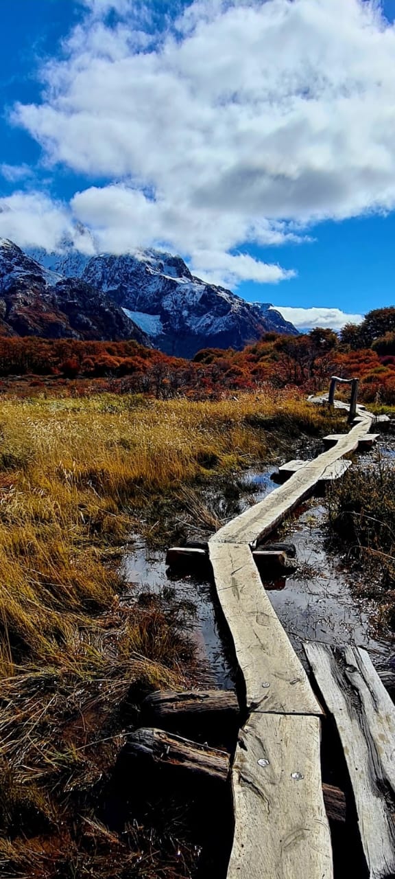
Con una vista (en día despejado¡¡) privilegiada de 360 grados nos permite la contemplación de ambos cordones y una vista que llega hasta el Lago Viedma. Este sendero comienza desde el centro de visitantes de parques.
Se comienza por un paisaje estepario, hasta llegar a un bosque de lengas.
Al cabo de un rato se llega a un claro, un col con vista al Valle del río Túnel y más lejos el paso del viento.
A nuestra derecha podemos ver una ante Cumbre perteneciente al Pliegue Tumbado.
Desde esta Cumbre ya tenemos una vista única y Desde allí se puede apreciar un filo cumbrero hacia el oeste.
El suelo en el pliegue Está compuesto por pizarra y se puede apreciar fósiles marinos (recuerden que no está permitido retirar nada del parque).
Tiempo estimado de marcha 10/11 horas aproximadamente.
Piedra del fraile-Rio Electrico
De camino al pasó Marconi (uno de los pasos al campo de hielo) este sendero arranca 16 kilómetros del Chaltén, por la ruta que lleva al Lago del desierto.
Desde el puente sobre el río eléctrico, comienza la senda que luego de dos y medio nos llevara hasta el campamento Piedra del Fraile (esto es propiedad privada, por lo que es necesario pagar un pase, pero Vale totalmente la pena¡¡).
Una vez rodeada en la Piedra (un morro haciendo de protección del camping) un paisaje totalmente distinto se abre, si se sigue 1 y medio más se llega hasta el Rio Pollones (recomendamos no cruzar).
Tiempo de marcha 5 horas aproximado (hasta piedra de fraile).
8 horas aproximadamente (con trekking hasta rio pollones).
Chorrillo del Salto
Caminata sencilla de 6 kilómetros, Dónde se visita el Chorrillo del Salto un pequeño pero encantador salto de aprox. 20 metros de altura.
Saliendo por la ruta al Lago del Desierto de tránsito 5 kilómetros hasta el parking donde sale un sendero de 15 minutos hasta el chorrillo.
Sitio sin visitar a los cordones pero sumamente agradable y protegido.
Para aquellos sin auto, se toma la misma ruta y a los 3 kilómetros se puede tomar un desvío de sendero que marcha al lado de la ruta.
Mirador cóndores y águilas
Senderos interpretativos que parten desde el centro de visitantes de parques.
Ambos con excelente vista y corto en su recorrido.
El mirador de los cóndores tiene una panorámica vista del pueblo y ambo cordones, Mientras que el de las Águilas se asoma hacia el lado del Lago Viedma.
Recomendado para visitar en las puestas de sol y amaneceres para la famosa fotos con el Fitz y Torre y enrojecido (sólo con buen clima ¡).
Opciones de guiada
Si bien debido a su dificultad no es necesario, vale destacar que el hecho de contratar un guía para estas salidas, enriquece muchísimo el contenido de las mismas debido reconocimiento de flora, fauna e historia de los guías.
OTRAS OPCIONES
Algunas otras opciones para no perderse (es necesario hacerlas con guía o tener conocimientos de andinismo
pernoctar en el fondo del Valle del Cerro Torre: una o dos noches de campamento en el fondo del Valle del Torre, de las vistas desde aquí son únicas¡¡
Vuelta al hielo expedición de 6 a 8 días donde se transita por el campo de hielo Sur
Vuelta al Cerro Huemul un excelente opción de 4/5 días para tener un excelente vista del campo de hielo si la necesidad de adentrarse en el
Más info sobre estas salidas con guía en nuestros links sugeridos
Algunas lecturas previas o para el viaje:
• Patagonia: tierra mágica para viajeros
Silvia Metzelin y Gino Buscaini
Editorial Desnivel
ISBN: 84-89969-57-4
• Trekking en Chaltén y Lago del Desierto
Miguel Alonso
ISBN: 987-21012-0-5
• Cazando Pumas en la Patagonia
Andreas madsen
• Patagonia las leyes del bosque
Eduardo G. de la Vega
Editorial contacto Silvestre
ISBN: 987-97402-2-X
• Patagonia las leyes de la estepa
Santiago G. de la Vega
Editorial contacto Silvestre
ISBN: 987-21141-5-3
• Patagonia las leyes de la alta montaña
Santiago G. de la Vega
editorial de contacto Silvestre
ISBN: 9789872114183
• Manual del Lago Argentino Glaciar Perito Moreno
Miguel Alonso
Editorial Zagier y Urruty
ISBN: 1-879568-22-5
• Aves de la Patagonia y Antártida
Tito Narosky, Darío Izurieta
Editorial Vázquez Mancini
ISBN: 987-9132-09-2
• Flora de la Patagonia: Bosques australes
Claudia Guerrido y Damian Fernandez
• Patagonia trágica
José María borrero
Editorial Zagier y Urruty
ISBN: 1879568022
• Poblamiento de la Patagonia
Luis Alberto borrero
Editorial Emece
ISBN: 950-04-2245-X
• la Patagonia vieja
Andreas madsen
Editorial Zagier y Urruty
ISBN: 1-879568-62-4
Pequeña lectura recomendada para cualquier viajante
Preparándonos para el viaje
Antes de emprender El viaje conviene averiguar cómo es el lugar a visitar de ese modo lo aprovecharemos más y mejor.
Pensemos en pensar lo que necesitaremos, para no molestar a nadie e innecesariamente: un botiquín por ejemplo no debe faltar.
Debemos ajustarnos a la naturaleza y no pretender que ella se ajuste a Nosotros. Sí no conocemos bien un lugar no encaremos emprendimientos riesgosos (Cómo cruzar un río, trepar por una ladera empinada, conducir por un camino desconocido y menos durante la noche.
Si en la ruta encontramos un vehículo parado debemos detenernos para preguntar si su ocupante necesita ayuda.
Esto es muy importante y tradicional en toda la Patagonia.
Si tenemos libros que ya no leemos donémoslos a escuelas del interior los alumnos y maestros están muy agradecidos.
Si nos encontramos con un puestero o poblador rural saludémoslo. Y si nos invitan a matear no hay por qué negarse sin desearlo se puede herir A quién ofreció su hospitalidad. No demos cátedra a los lugareños porque son simples y tímido pero no ignorantes.
Conversemos con los guardabosques y guarda faunas seguramente tendrás muchas cosas interesante para contarlo y enseñarnos.
Los camping de las áreas protegidas son excelentes lugares para hacer observaciones de fauna y los animales suelen mostrarse más confiados porque saben que hay alimento y que nadie les hace daño.
Hagamos fuego en los sitios autorizados y sólo cuando sea necesario apaguémoslos bien con abundante agua es la única forma de evitar incendios.
Depositemos nuestra basura en un lugar adecuado Y si en el camino nos encontramos conservémoslas hasta dar con ellos.
No recojamos plantas o animales como recuerdos de viaje. En la mayoría de los casos está prohibido hacerlo y además difícilmente sobreviven mucho tiempo no hay mejor recuerdo que una imagen Viva en nuestro Recuerdo o una linda foto.
Si recogemos semillas a la vera de los caminos fuera del parque nacionales o provinciales pero después plantarlas en casa.
¡Qué mejor que tener un jardín con plantas autóctonas en nuestra patria¡
Nunca lo sabremos todo pero con dedicación cada vez más sabremos más. Evitemos acto de depredación de otros viajeros educando o explicando con comprensión.
Dejemos que la naturaleza se desenvuelva normalmente como si no estuviéramos.
Dejemos todo igual o mejor que cómo estaban a nuestro paso.
Llevar un diario de viaje puede ser muy gratificante.
Salgamos al campo con humildad y regresemos a casa con satisfacción.
Compartamos la enseñanza de la naturaleza y la de nuestros maestros.
No prometamos lo que no podemos cumplir (con frecuencia se escucha “después le mandó la foto” y quedará el hombre de campo “esperando La carroza”)
Un amante de la naturaleza es considerado con ella y con las personas. Hay que tener sentido común y un buen corazón eso es lo fundamental ¡buen viaje¡
Por Claudio Bertonatti
• Les recomendamos venir preparado para un clima que puede variar mucho.
• A todos aquellos que tan acostumbrado a andar por el monte, sabrán a qué atenerse más allá de que la siguiente lista puede servir de carácter orientativo.
• Es para todos aquellos que no suelen ir a la montaña, que damos un poco más de detalle sobre la preferencia de Cómo deben disponerse las prendas.
• Siempre conviene vestirse como una cebolla es decir por capas y se recomiendan prendas livianas porque tal vez uno se quita y pone muchas ropa de salir a caminar y es bueno tenerlo en cuenta para acomodar el contenido de nuestra mochila (recuerden: en la mochila lo más pesado abajo y arriba lo liviano y más probable de necesitar campera de lluvia guantes, etc).
• Lista de equipo (para salidas diarias)
• Windstopper (cortavientos)
• Campera lluvias (recomendamos que sea liviana)
• Gorro para el sol y gorro de lana (para cubrir ñas orejas y proteger la cabeza que junto los pies Es por donde ganamos o perdemos gran parte de nuestro calor corporal por falta de acumulación de tejido adiposo Al fin y al cabo en algún lado nos tocaba no engordar.
• Anteojos gafas de sol.
Our Patagonian climate stands out for two reasons: strong gusts of winds and a particular unpredictable and changeable character. How we usually joke: Patagonia? All four seasons in one day, but twice!
There is no characteristic month for its good weather but rather it is a kind of lottery. Therefore it is impossible to recommend a month for your visit.
Beyond this, the end of spring, summer and the birth of autumn are usually the time of greatest influx of visitors to this National Park with the characteristic of especially long days due to our proximity to the South Pole as opposed to the scarce amount hours with sunlight on a typical winter day; (in summer there may be light from 5 am to 10:30 pm) which gives us plenty of scope for longer and more demanding walks at a more relaxed pace.
Keep in mind the days begin to lengthen in mid-November when there is daylight until 9/9: 30 P.M.
Autumn (late March, April and early May), although with shorter days, is usually the most special and beautiful time due to the coloring of the forests and the nothofagus, Lengas and Ñires, characteristic trees of the area, have deciduous leaves. In other words, they lose their leaves in winter but not before taking on a gradual and intense coloration that goes from yellow to intense red and the town becomes a little calmer and quieter due to the decrease in the influx of visitors.
El Chaltén is a small and astonishingly young town, located 218 km northwest of the town of Calafate.
Bus:
The route from El Calafate is approx. 3 ½ hours. Check the validity of schedules and rates with each company.
DON ATILIO:
reservas@zonaaustralturismo.com
price per section:
frequency coordinated with the arrival and departure of flights to and from El Calafate airport
TAQSA:
Tel 02962 493130
taqsaech@taqsa.com.ar
price per section: $ 2,900
frequency: El Calafate El Chalten 7.30 am
El Chalten – El Calafate 17.30
LAS LENGAS:
laslengaselchalten@yahoo.com.ar
Tel 02962 493023
price per section: $ 650
frequency: 7:30 am and throughout the day from the airport coordinated with the returns
Also direct from El Calafate airport direct to your accommodation in El Chalten
Caltur:
terminalchalten@hotmail.com
tel 02962 493 150
Price per section $ 600
departs 8, 13 and 18:30
Chalten Travel:
infochalten@chaltentravel.com
02962 493 192
Price per section $ 600
departs 8, 13 and 18:30
Tickets can always be obtained directly at the El Calafate Bus Terminal and those of the Caltur and Chalten Travel companies, which are the largest, can be obtained in advance at
www.plataforma10.com
Car:
218 kilometers from Calafate by provincial route 11, national route 40 and provincial route 23 or 41 (Asphalted)
468 kilometers from Río Gallegos by route 5, provincial route 11, national route 40 and provincial route 23. (Asphalted)
Airplane:
El Chaltén does not have its own airport. The closest airports are El Calafate (with more than 10 daily flights by Aerolineas Argentinas, JetSmart and Flybondi), Río Gallegos, and Ushuaia.
El Chaltén stands out for having a wide variety of outdoor activities of which the most practiced in trekking and climbing, be it alpine or sports!
And here are some suggestions, those places that we recommend not to miss on your way through Chaltén.
To take into account: walking is only about putting a coat and something to eat and a bottle of water in your backpack and going out to enjoy our surroundings for free, without prior reservations and without pre-established schedules. We also offer you some organized activities which do have a cost …
To all those who are going to carry out activities in the National Park, we recommend visiting the visitor center at the National Parks office: There you will be provided with information on the trails, their duration and difficulty, information on flora, fauna and history of the alpinimo del place: Not to be missed!
Remember when walking: first of all: enjoy.
If at any time you feel any discomfort (rubbing of the boot, knee pain) from the return since you still have the return. Although the published times are indicative, use walking hours, and do not forget that the time of going will be the same as that of return!
EXCURSIONS
TREKKING
To walk out from inlandsis:
Fitz Roy
El Pilar/campamento Poincenot/mirador piedras blancas/laguna de los tres Laguna Capri/Chaltén
This path offers us the closest panoramic view of the Fitz Roy cordon.
You can start from El Chalten, simply walking to the north exit of the town, taking there on the trail.
Either from the El Pilar inn 15 kilometers away, El Chaltén can be done by car or transfer – every day with a pickup at the inn at 8:30
Our recommendation is to start from Pilar, since in this way we simply walk back to El Chaltén, and the route is shorter and with a greater view.
Leaving the Pilar after 2 hours of walking you will reach the viewpoint of the Piedras Blancas glacier and its homonymous lagoon.
Continuing along the path for another 40 minutes, you will arrive at the Poincenot camp (camp for hikers)
The path that follows is the lagoon of the three is steep and demanding.
Cross the Piedra Blanca river and then cross the Río Blanco camp (camp only for climbers)
Here the trail begins to get steep and after 1.45 you reach the lagoon of the three.
From here you get a beautiful and the closest view of the Fitz Roy cordon.
To return: from the Poincenot camp, take the path that El Chaltén indicates and it will take you through the Capri lagoon hotel town in 2:30 hours.
Or you just take the road to Pilar in case you have left your car there.
Total walking time 9/10 hours approximate.
Cerro Torre
Laguna Torre – Campamento de Agostini – Mirador Maestri
This trail starts from the town. The same transit through the Fitz Roy River Valley.
After an hour and a half of walking, you will reach the Torre viewpoint from where you can see the cordon of Cerro Torre and it is even visible in Cerro Fitz Roy.
After a further 1.40 hours of walking, you will arrive at Agostini’s camp.
Continuing the walk for another 15 minutes, you will reach the Torre lagoon, with a beautiful view of the large glacier and the Torre cordon.
For those who want to walk a little more, we recommend continuing to the Maestri viewpoint, surrounded by the lagoon by its moraine to our right.
Total walking time 8/9 hours approximate.
Loma del pliegue tumbado
La Loma del pliegue tumbado is one of our favorites.
With a privileged 360 degree view (on a clear day! This trail starts from the parks visitor center.
You start with a steppe landscape, until you reach a lenga forest.
After a while you come to a clearing, a col with a view of the Tunnel River Valley and further away the passage of the wind.
To our right we can see an ante Cumbre belonging to the Pliegue Tumbado.
From this Summit we already have a unique view and from there you can see a ridge to the west.
The ground in the fold It is composed of slate and you can see marine fossils (remember that it is not allowed to remove anything from the park).
Estimated walking time 10/11 hours approximately.
Piedra del fraile-Rio Electrico
On the way to the Marconi pass (one of the steps to the ice field), this trail starts 16 kilometers from El Chaltén, along the route that leads to the Lake of the desert.
From the bridge over the electric river, the path begins that after two and a half will take us to the Piedra del Fraile camp (this is private property, so it is necessary to pay a pass, but it is totally worth it!).
Once surrounded by the Piedra (a hill protecting the campsite), a totally different landscape opens up. If you follow 1 and a half more, you will reach the Rio Pollones (we recommend not crossing).
Walking time 5 hours approximate (to Friar’s Stone).
8 hours approximately (with trekking to the Pollones River).
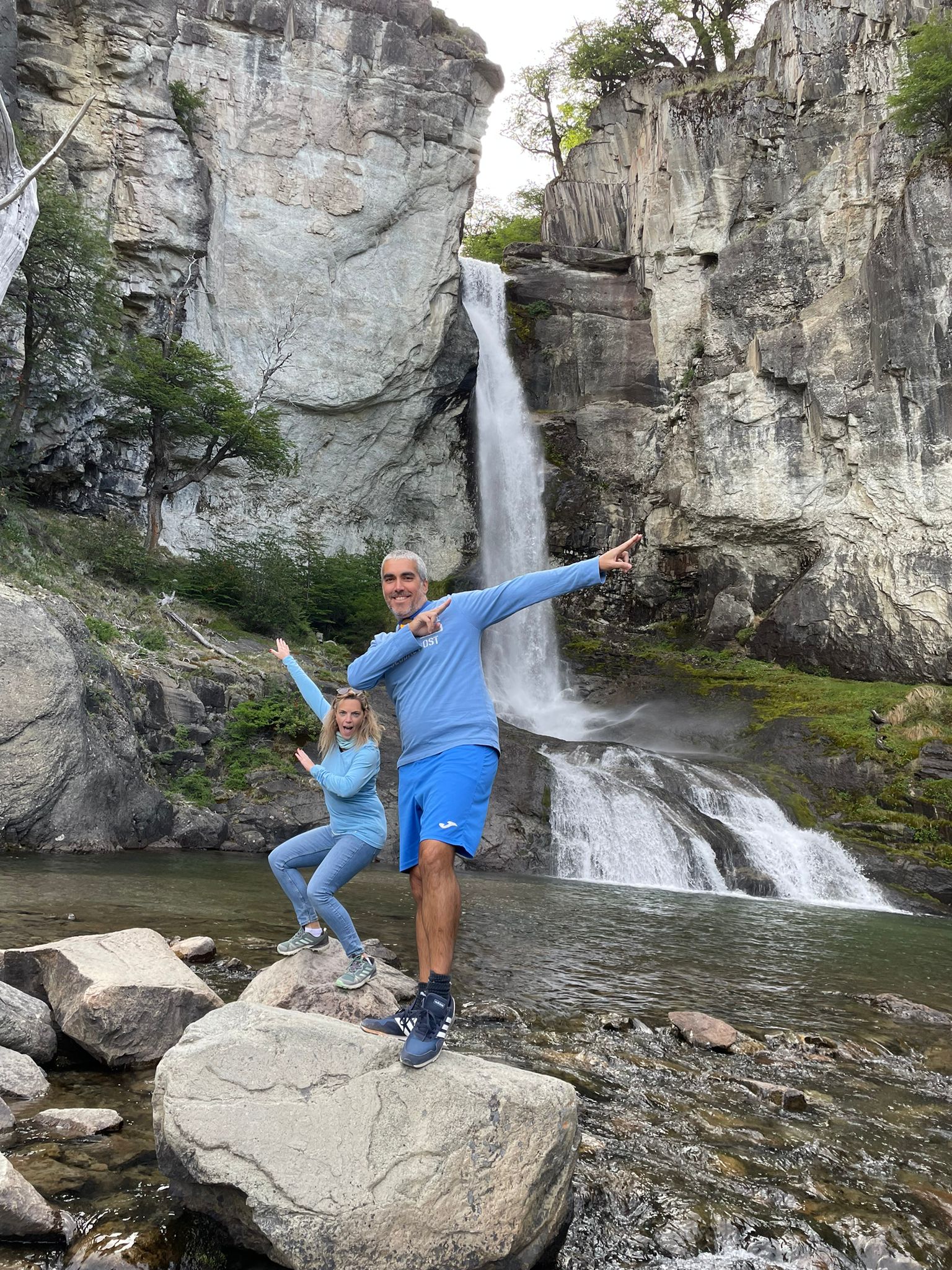
Chorrillo del Salto
Simple walk of 6 kilometers, where you visit the Chorrillo del Salto a small but charming jump of approx. 20 meters high.
Leaving the route to the Lake of the Desert of transit 5 kilometers to the parking where a 15-minute path leaves to the chorrillo.
Site without visiting the laces but extremely pleasant and protected.
For those without a car, you take the same route and after 3 kilometers you can take a detour to the trail that runs alongside the route.
Mirador cóndores y águilas
Interpretive trails that start from the park visitor center.
Both with excellent eyesight and short on their way.
The viewpoint of the condors has a panoramic view of the town and both mountain ranges, while that of the Eagles looks out towards the side of Lake Viedma.
Recommended to visit in the sunsets and sunrises for the famous photos with the Fitz and Torre and flushed (only in good weather!).
Guidance options
Although due to its difficulty it is not necessary, it is worth noting that the fact of hiring a guide for these outings greatly enriches their content due to the recognition of flora, fauna and history of the guides.
OTHER OPTIONS
Some other options not to get lost (it is necessary to do them with a guide or have knowledge of mountaineering
spend the night at the bottom of the Cerro Torre Valley: one or two nights of camping at the bottom of the Torre Valley, the views from here are unique!
Return to the ice expedition of 6 to 8 days where you travel through the South ice field
Return to Cerro Huemul an excellent option of 4/5 days to have an excellent view of the ice field if the need to enter the
More info about these guided outings in our suggested links.
Some previous reading or for the viaje:je:
• Patagonia: tierra mágica para viajeros
Silvia Metzelin y Gino Buscaini
Editorial Desnivel
ISBN: 84-89969-57-4
• Trekking en Chaltén y Lago del Desierto
Miguel Alonso
ISBN: 987-21012-0-5
• Cazando Pumas en la Patagonia
Andreas madsen
• Patagonia las leyes del bosque
Eduardo G. de la Vega
Editorial contacto Silvestre
ISBN: 987-97402-2-X
• Patagonia las leyes de la estepa
Santiago G. de la Vega
Editorial contacto Silvestre
ISBN: 987-21141-5-3
• Patagonia las leyes de la alta montaña
Santiago G. de la Vega
editorial de contacto Silvestre
ISBN: 9789872114183
• Manual del Lago Argentino Glaciar Perito Moreno
Miguel Alonso
Editorial Zagier y Urruty
ISBN: 1-879568-22-5
• Aves de la Patagonia y Antártida
Tito Narosky, Darío Izurieta
Editorial Vázquez Mancini
ISBN: 987-9132-09-2
• Flora de la Patagonia: Bosques australes
Claudia Guerrido y Damian Fernandez
• Patagonia trágica
José María borrero
Editorial Zagier y Urruty
ISBN: 1879568022
• Poblamiento de la Patagonia
Luis Alberto borrero
Editorial Emece
ISBN: 950-04-2245-X
• la Patagonia vieja
Andreas madsen
Editorial Zagier y Urruty
ISBN: 1-879568-62-4
Short recommended reading for any traveler
Preparing for the trip
Before embarking on the trip, it is advisable to find out what the place to visit is like so that we will take advantage of it more and better.
Let’s think about thinking about what we will need, so as not to disturb anyone and unnecessarily: a first-aid kit for example should not be missing.
We must adjust to nature and not pretend that it adjusts to Us. If we do not know a place well, we will not face risky undertakings (How to cross a river, climb a steep slope, drive on an unknown road and less at night.
If we find a stationary vehicle on the route, we must stop to ask if its occupant needs help.
This is very important and traditional throughout Patagonia.
If we have books that we no longer read, let’s donate them to schools in the interior, the students and teachers are very grateful.
to do so, it can hurt who offered their hospitality. Let’s not lecture the locals because they are simple and shy but not ignorant.
Let’s talk with the rangers and wildlife guards, surely you will have many interesting things to tell and teach us.
Protected area campsites are excellent places to observe wildlife, and animals tend to be more confident because they know that there is food and that no one is hurting them.
Let us make fires in authorized places and only when necessary, extinguish them well with plenty of water is the only way to avoid fires.
Let’s deposit our garbage in a suitable place. And if we find ourselves along the way, let’s keep it until we find it.
We do not collect plants or animals as travel souvenirs. In most cases it is forbidden to do so and also hardly survive long there is no better memory than a Live image in our Memory or a beautiful photo.
If we collect seeds on the side of the roads outside the national or provincial parks but then plant them at home.
What better than to have a garden with native plants in our homeland!
We will never know everything but with more and more dedication we will know more. Let us avoid act of predation of other travelers educating or explaining with understanding.
Let nature unfold normally as if we were not there.
Let us leave everything the same or better than how they were in our path.
Keeping a travel journal can be very rewarding.
Let us go out to the field with humility and return home with satisfaction.
Let us share the teaching of nature and that of our teachers.
Let us not promise what we cannot deliver (often you hear “after he sent the photo” and the man from the field will be left “waiting for the float”)
A nature lover is considerate of nature and people. You have to have common sense and a good heart that is the fundamental thing. Have a good trip!
Por Claudio Bertonatti
• We recommend that you come prepared for a climate that can vary greatly.
• To all those who are so used to walking in the mountains, they will know what to expect beyond the fact that the following list can serve as a guide.
• It is for all those who do not usually go to the mountains, that we give a little more detail about the preference of How the garments should be arranged.
• It is always advisable to dress like an onion that is to say in layers and light garments are recommended because perhaps one takes off and puts on a lot of clothes to go for a walk and it is good to take this into account to accommodate the contents of our backpack (remember: in the backpack it is heavier down and up the light and more likely to need a rain jacket, gloves, etc).
• Equipment list (for daily departures)
• Windstopper
• Rain jacket (we recommend that it be light)
• Sun hat and wool hat (to cover the ears and protect the head that brings the feet together. It is where we gain or lose much of our body heat due to lack of accumulation of adipose tissue. It was time not to get fat.
• Glasses sunglasses.